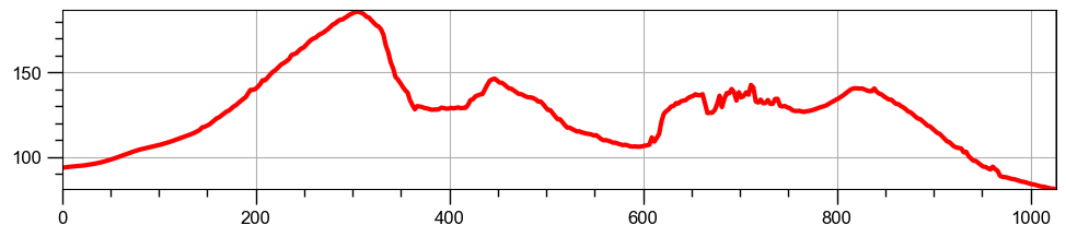
The Terrain Profile plugin in QGIS is a great way to quickly visualise changes in elevation along an axis. You’ll just need a Digital Terrain Model (DTM), like Environmental Agency LiDAR. Then simply plot a 2D line accross the DTM:
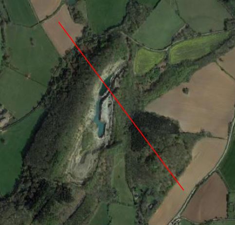
You then have a neat elevation profile graph, this one picks out the cliff face of the quarry very well: