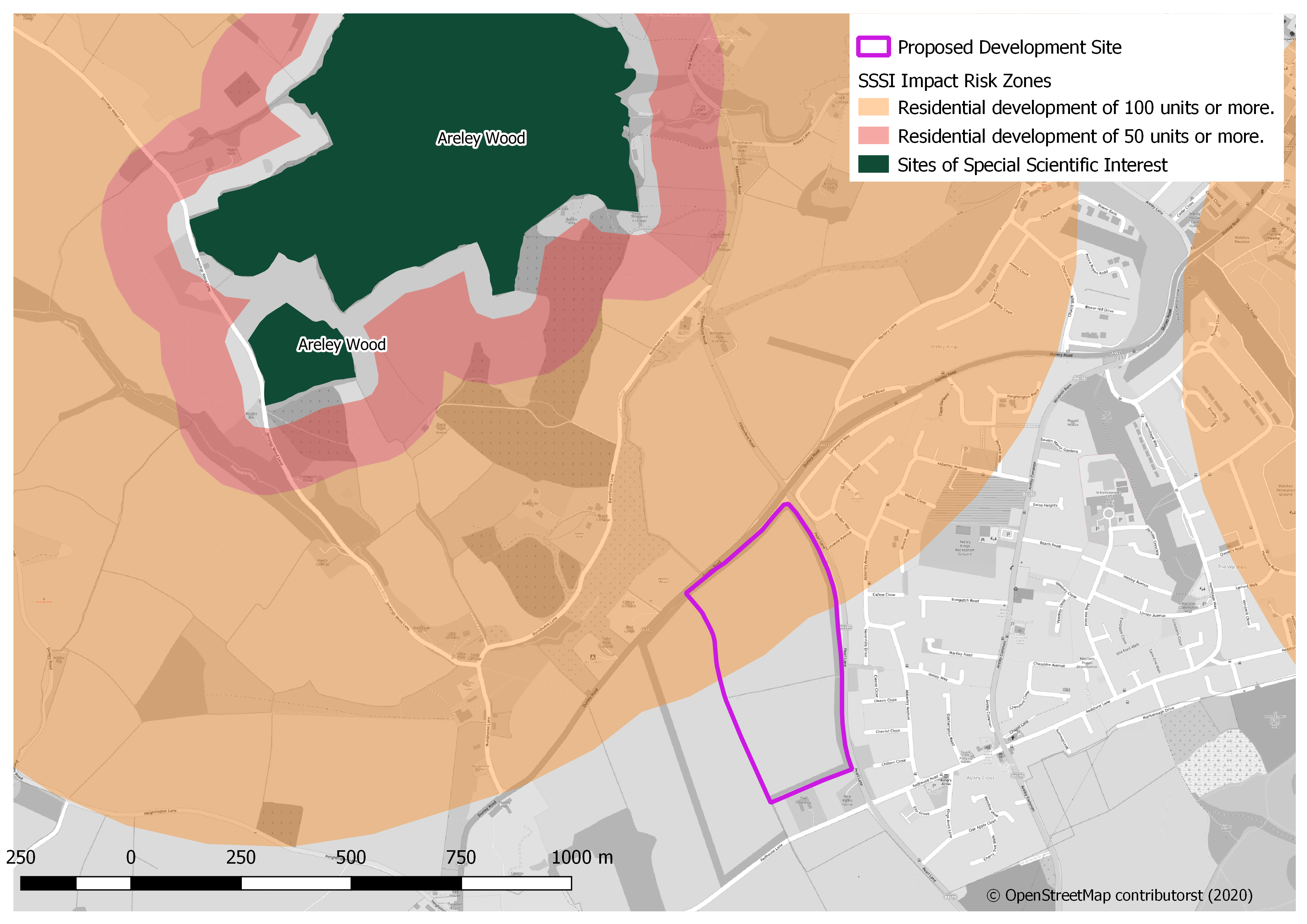
Natural England, the government’s advisor for the natural environment in England have an excellent geoportal for viewing and downloading special data. There are numerous open access spatial datasets concerning: nature reserves, national parks, natural habitats, ancient woodlands, and areas of scientific and conservation interest. I have included a map I made below, in QGIS, which shows the impact risk zones around a SSSI (Site of Special Scientific Interest) which is current in danger of having a housing estate built nearby.